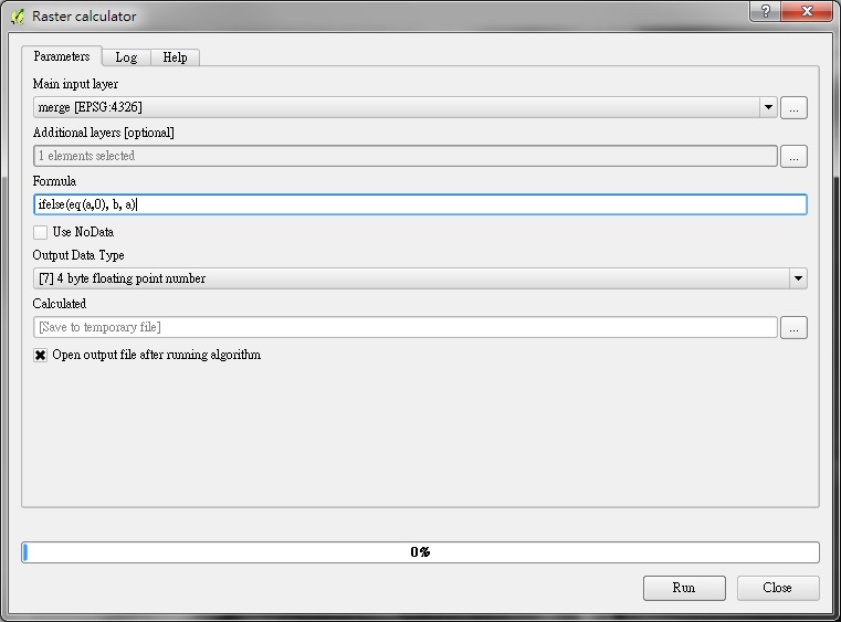
Open Processing algorithm: Raster calculator
 |
| QGIS 2.10.x |
- Additonal layers
Select second input layer ( as variable b, low resolution Bathymetry )

- Formula
ifelse(eq(a,0), b, a)
if a == 0 then output b else output a
- Result
The resulting layer ( the resolution of the main input layer will be used. )

Note :
Operator for formula :
Replace the values zero (sea level) of the first layer with the values from the second layer (Bathymetry).
The layer variables name are named using letters a, b, c... or g1, g2, g3...
Operator for formula :
+ Addition
- Subtraction
* Multiplication
/ Division
^ power
abs(x) - absolute value
sqrt(x) - square root
ln(x) - natural logarithm
log(x) - base 10 logarithm
exp(x) - exponential
sin(x) - sine
cos(x) - cosine
tan(x) - tangent
asin(x) - arcsine
acos(x) - arccosine
atan(x) - arctangent
atan2(x, y) - arctangent of x/y
gt(x, y) - if x>y the result is 1.0, else 0.0
lt(x, y) - if x<y the result is 1.0, else 0.0
eq(x, y) - if x=y the result is 1.0, else 0.0
mod(x, y) - returns the floating point remainder of x/y
ifelse(c, x, y) - if c=1 the result is x, else y
int(x) - integer part of floating point value x
pi() - returns the value of Pi

沒有留言:
張貼留言